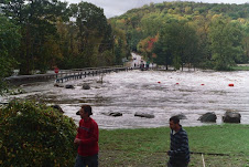
Yesterdays rain did not concern me. I knew the river could handle what was coming, but, I always find it interesting to monitor it. In the past we have found ourselves glued to this site, while the waters rose up around us. We get a overwhelming sense of relief when the blue line starts to level off, and turn downward.
The graphs below are from this past week. At approximately 12pm 1-25-2010, yesterday afternoon the river stared to climb. The gauge height was 3.5' and was moving at 150 Cubic Feet Per Second.(cfs)
When the rain stopped at 4:30 pm the height registered at 5.5, and the flow rate was at 752 cfs, and it still continued to raise for several more hours.
Just before midnight, it started to level off at 7.73', with the flow rate at 1080 cfs. I placed a red arrow a the turning point, and a green arrow which is the point the river started to raise.


1 comment:
Thanks for the lesson in how to gauge the water. The Susquehannah (sp?) over flowed it's banks in Wyoming County in PA. It was pretty scary watching on the news... We are up high in Wayne County so we don't have to worry.
Keep up the good work, I learn from you every time! Love, Mom
Post a Comment